
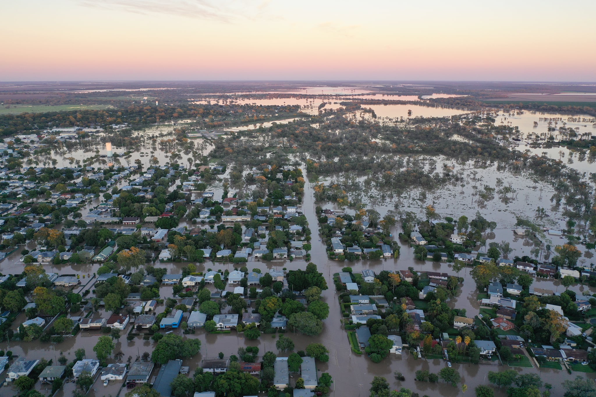
Narrabri and the district experienced heavy rainfall in early February 2020.
Localised intense rainfall north-east of Narrabri resulted in flooding of Horsearm Creek and Doctors Creek.
With the region having experienced years of drought, the Namoi River and Narrabri Creek were not flowing at the time of the February 2020 event.


WRM Water and Environment Pty Ltd was commissioned by Narrabri Shire Council to validate the recently completed hydrologic and hydraulic models developed of the local Narrabri creek catchments to the available data for the February 2020 event.
Council’s appointed consultants WRM have recently completed a draft Narrabri floodplain risk management study and plan volume 1: supplementary flood study – Namoi River, Mulgate Creek and Long Gully addendum 1 – February 2020 validation (the draft supplementary addendum).
The draft supplementary addendum was discussed at a previous meeting of the Narrabri Shire floodplain risk management committee held on November 17, 2020 and was recommended for public exhibition at the April ordinary council meeting.
The draft supplementary addendum has now been placed on public exhibition for 28 days, after which time, council will receive a further report and consider any submissions.
Council advised that the draft supplementary addendum should be read in conjunction with the supplementary flood study (WRM, 2019) and 2016 flood study (WRM, 2016).
The approach adopted to assess the February 2020 event is consistent with the supplementary flood study (WRM, 2019) the council said.
General manager, Stewart Todd praised the council’s planning department for its quick action after the February 2020 flood event, particularly in their consultation with the community to gain their input as how the flooding affected them and tying it in to current studies being undertaken as part of the draft Narrabri floodplain risk management study and plan.
“This consultation and investigations into the events in February 2020 have found that predicted peak flood levels from flood modelling were on par and only being slightly lower to the actual recorded levels in 2020.
“While any flooding is extremely devastating to those affected, the data gathered from the February 2020 event and particularly the data obtained from the community through their experiences, was extremely important and useful information.
“This data has validated the modelling the council has done in predicting future flooding in Narrabri.
“A community survey was distributed with council rate notices in April 2020 and 57 responses were received – this is an excellent response.
“Of the responses, 18 were from properties that experienced some form of flooding during February 2020. A number of photographs and videos of inundation during February 2020 were also supplied with survey responses, while further photographs were sourced from local media and social media.
- “The community survey responses were rather consistent, with most flood-affected properties reporting the following:
- Inundation for between one and five hours (some properties experienced inundation for longer periods);
- Peak inundation occurring between 3pm and 6pm on Saturday, February 8, 2020;
- Little to no warning of flooding; and
- Water levels rose extremely quickly.
“Overall, the supplementary flood study model has been successfully validated against the February 2020 data. The next step is the finalisation of the draft Narrabri floodplain risk management study and plan which is expected to be completed and on public exhibition by the end of 2021.”
Read more stories like this:
- Moree braces for major flooding, equal to 1971 event
- Spring Plains flood rescue: Grazier saves two trapped travellers
- Moree bands together after floods