
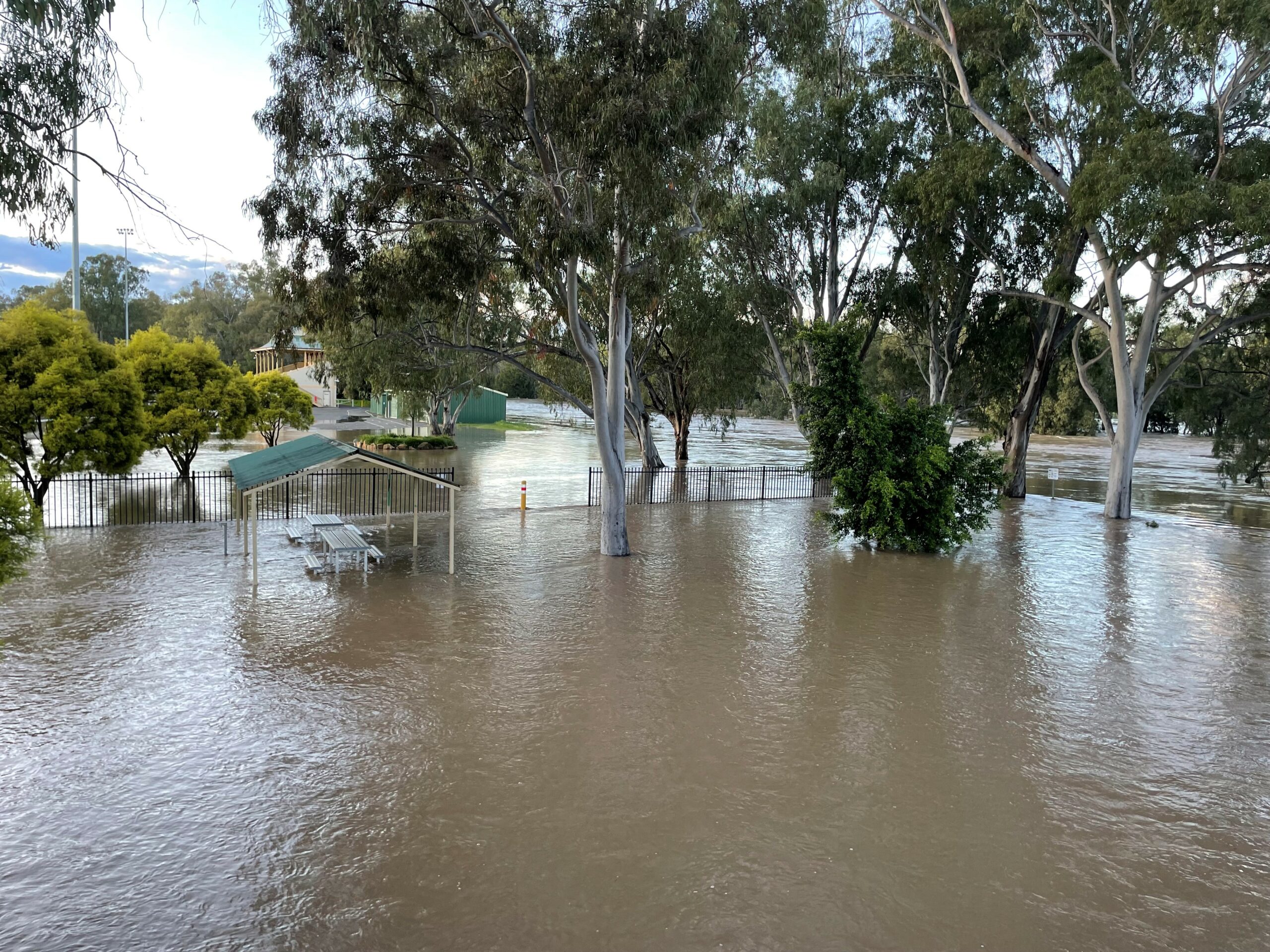
Residential streets were cut-off and town sewerage and water services were impacted as a result of major flooding in Narrabri.
The Narrabri Creek reached a revised peak of 7.67 metres on Tuesday afternoon, above earlier predictions of a 7.4-metre peak.
Emergency services and shire personnel have been working around the clock as a result of the flooding emergency occurring across the district.


An evacuation centre was established at The Crossing Theatre for impacted residents.
As of this afternoon, the Narrabri Creek continued on its slow decline and was 7.37 metres.
The SES has advised that the creek is expected to remain high, falling slowly as the water gradually makes its way downstream.
The heightened water levels have caused difficulties to Narrabri’s sewerage network, with council urging people to limit their water usage.
“Narrabri Shire Council advises residents at this time, to be conservative with their water usage across all streets in the town of Narrabri,” council advised on Tuesday.
“Please ensure you do not use excessive amounts of water and limit your consumption in the following areas, including but not limited to; reducing drinking water, washing dishes, and having long showers.”
The floods have also forced the closure of local roads in addition to continued closures on the Newell Highway and parts of the Kamilaroi Highway.
The operations of some local schools have also been impacted.
Extensive flood-related road closures also impacted the operation of some local businesses, with some forced to close as a result of employees being unable to get into town.
Among the streets within Narrabri closed to traffic earlier this week were Huxley Street, the intersection of Peele and Clarke Street, Fraser Street, The Island Road, Wilga Street, Ugoa Street at both ends, the intersection of Violet Street and Hinds Street, Selina Street and the Tibbereena Street/Fitzroy Street bend.
The SES, however, quelled rumours about the possibility of Cooma Road closing.
“If water goes over the road, we have slow signs in place and traffic control if needed,” the Narrabri SES Unit said.
On Monday night, emergency orders were introduced for parts of the town south of the Narrabri Creek, encouraging people to evacuate.
However, it was later clarified that due to the implementation of the new SES emergency warning system, an evacuation order had to be issued as properties would potentially see water enter on them.
“We have crews door knocking now. Please be respectful as they have been directed to do this,” the SES advised on Monday evening.
In other parts of the shire, the impacts of the flood have been similar.
Wee Waa has experienced another period of isolation as a result of ongoing flooding.
The SES has indicated that this may be for a more prolonged period of time than recently experienced.
The Namoi River at Wee Waa (Glencoe) was expected to peak near 7.6 metres today, with major flooding.
The situation continues to be monitored, with SES providing residents with essential goods.
In Boggabri, the Namoi peaked at 8.38 metres at 6pm on Monday and has been falling slowly with minor flooding.
Mayor Ron Campbell paid tribute to the work of the local and visiting emergency services, as well as the wider community, which are working tirelessly to keep communities safe.
“It is incredible to see the community pull together during this time to help assist the SES with distributing sandbags to residents in need,” he said.
“It is important that residents remain calm and listen to the directions of law enforcement and SES by ensuring they stay out of all floodwaters and adhere to road closure signage.”
To order photos from this page click here