
Australia’s national science agency, CSIRO, will conduct an airborne electromagnetic (AEM) survey of the Narrabri region using a helicopter for a two-week period in mid to late November.
The survey is part of a CSIRO Gas Industry Social and Environmental Research Alliance (GISERA) groundwater research project Understanding connectivity between coal seams and aquifers.
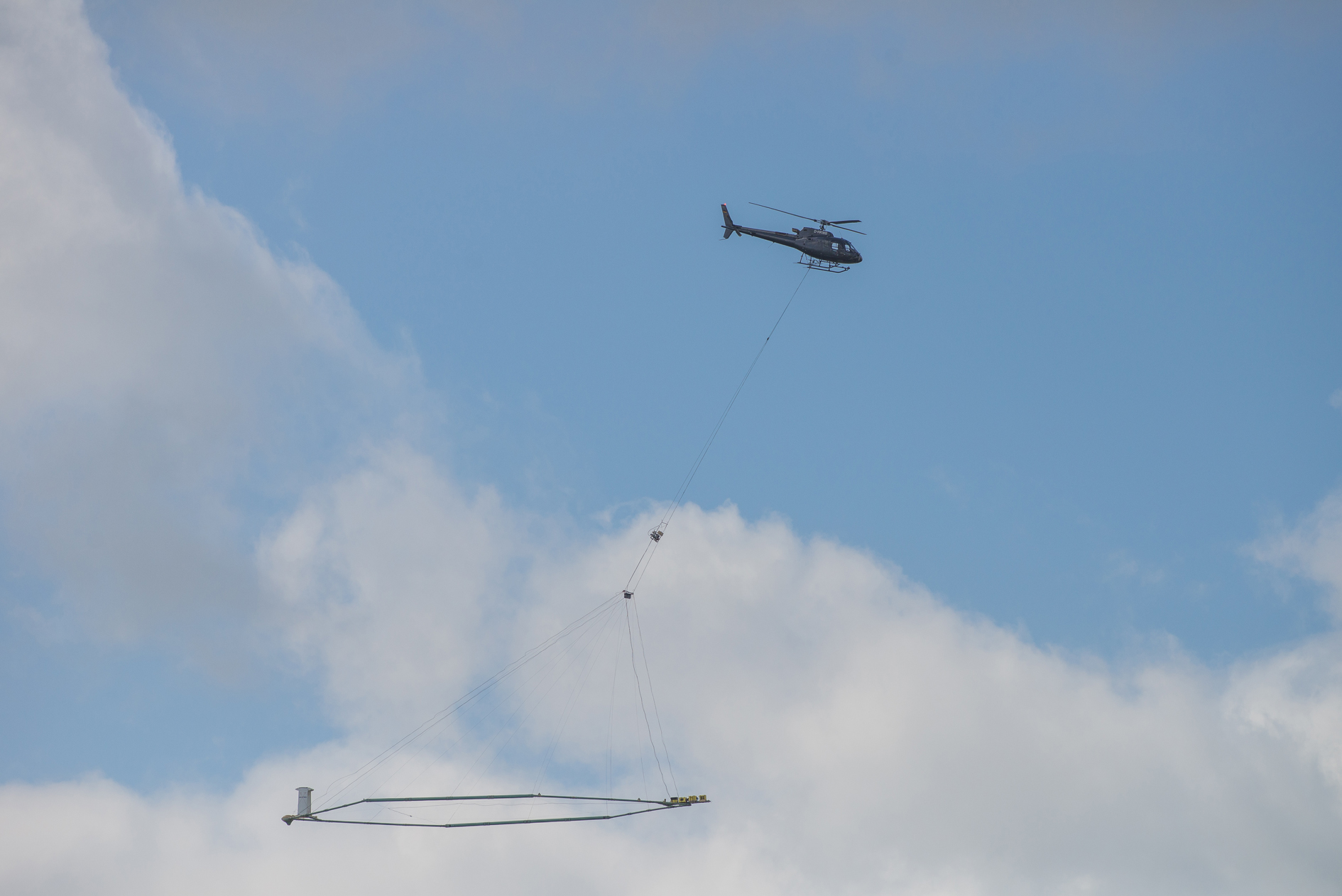
The CSIRO AEM survey in Narrabri will involve a helicopter flying at low altitude (about 60 metres) towing an electromagnetic array, which looks like a large, elongated hoop, at about 35 metres above ground level.


The survey flight path follows parallel straight lines – like a lawn mower pattern – over sections of the Pilliga Forest, and over agricultural land to the north and east of the Pilliga Forest.
The helicopter will fly daily, weather permitting, during daylight hours from around Friday, November 17 until Friday, December 1.
The helicopter pilot adheres to strict Civil Aviation Safety Authority requirements and wherever possible the helicopter will avoid towns, private residences, farmhouses, sheds and other infrastructure, livestock mustering and watering points, and steep terrain.
CSIRO has engaged AEM specialists SkyTEM Australia to collect electromagnetic (EM) data using specialised remote sensing equipment towed by the helicopter.
EM fields generated from the SkyTEM system are comparable with EM fields generated by powerlines, household wiring, or TV antennae.
AEMs are routinely used in Australia and around the world to obtain valuable scientific data about groundwater and other geologic features. AEM technology obtains information about sub-surface characteristics, such as changes in salinity and soil or rock types.
GISERA director Dr Damian Barrett said CSIRO research into groundwater and sub-surface characteristics in the Narrabri region reflected community concern on the potential for gas resource extraction to affect important shallow aquifers.
“This survey is important because it fills in the missing gaps about the geology of the region, from the surface to a depth of around 400 metres,” Dr Barrett said.
“This data will help identify or rule out geological intrusions or faults from deeper formations into these relatively unstudied shallow surface formations.”
CSIRO’s GISERA groundwater research project ‘Understanding connectivity between coal seams and aquifers’ is funded by the federal government ($770,000 – 68 per cent), the NSW government ($98,000 – nine per cent) and CSIRO in kind ($257,000 – 23 per cent).
All research results will be made public on the GISERA web site.
To order photos from this page click here