

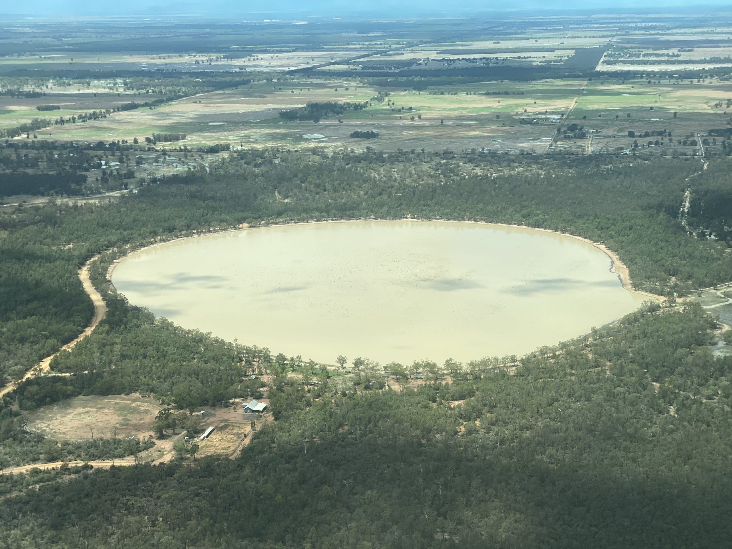
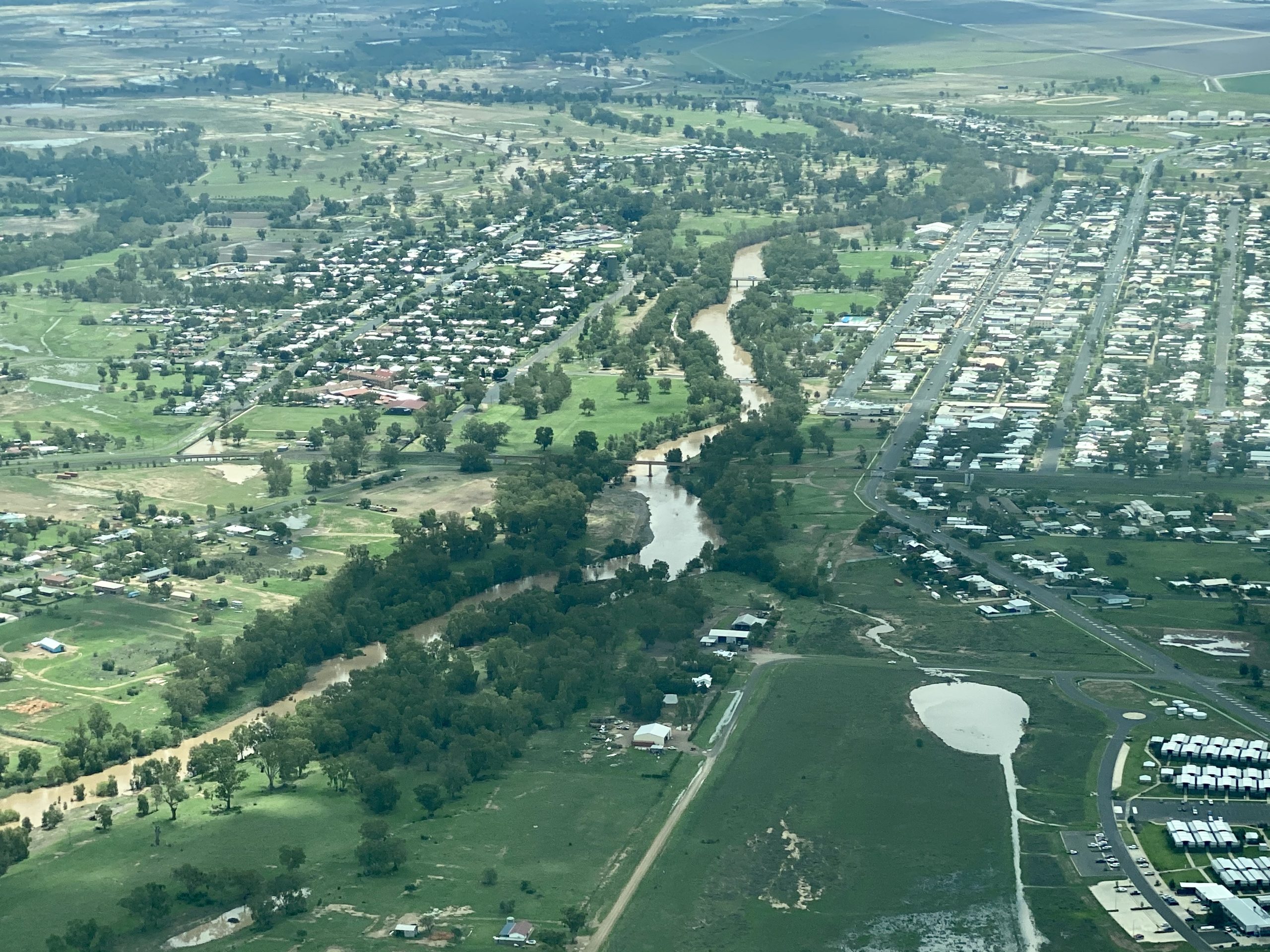
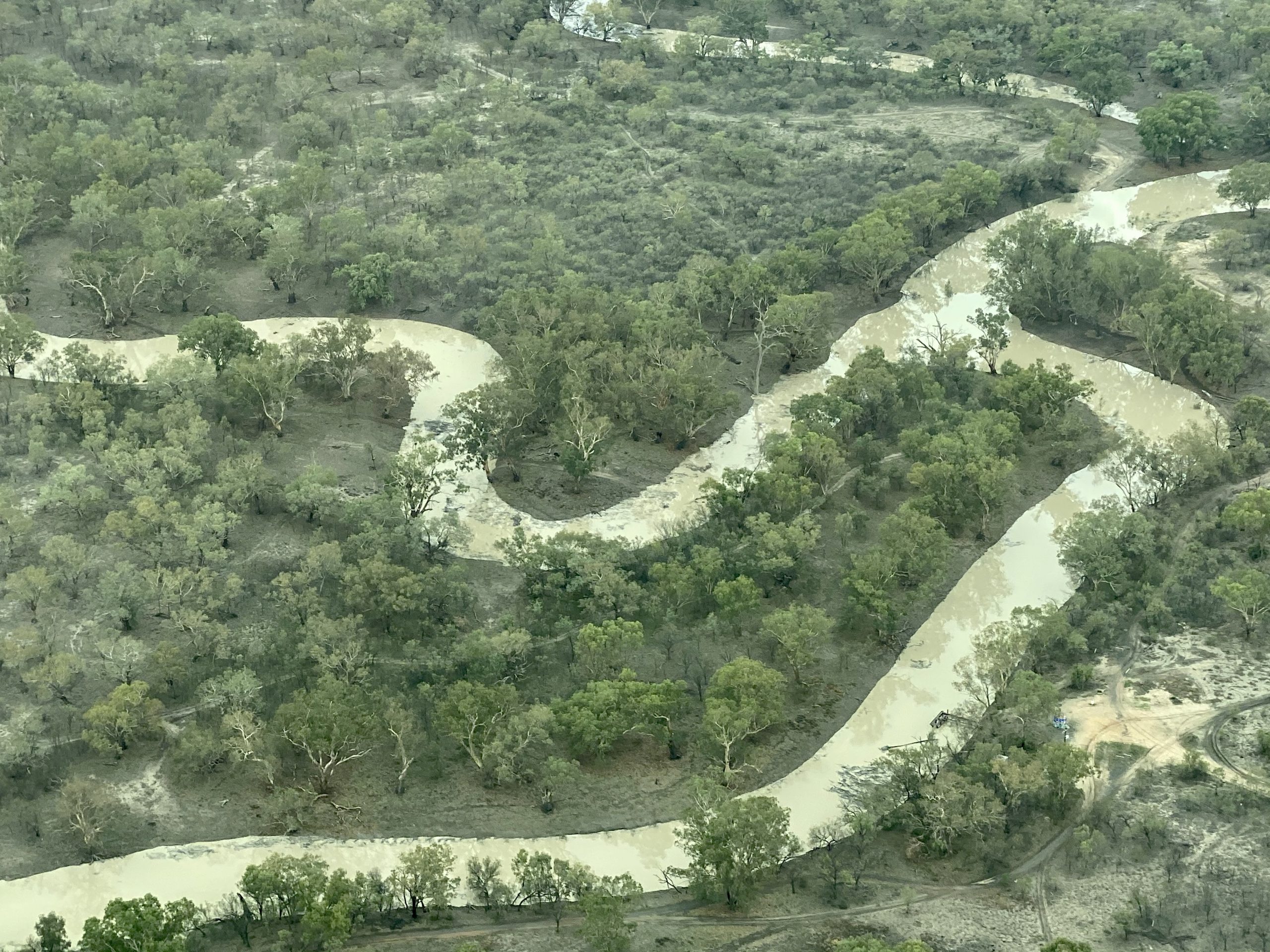
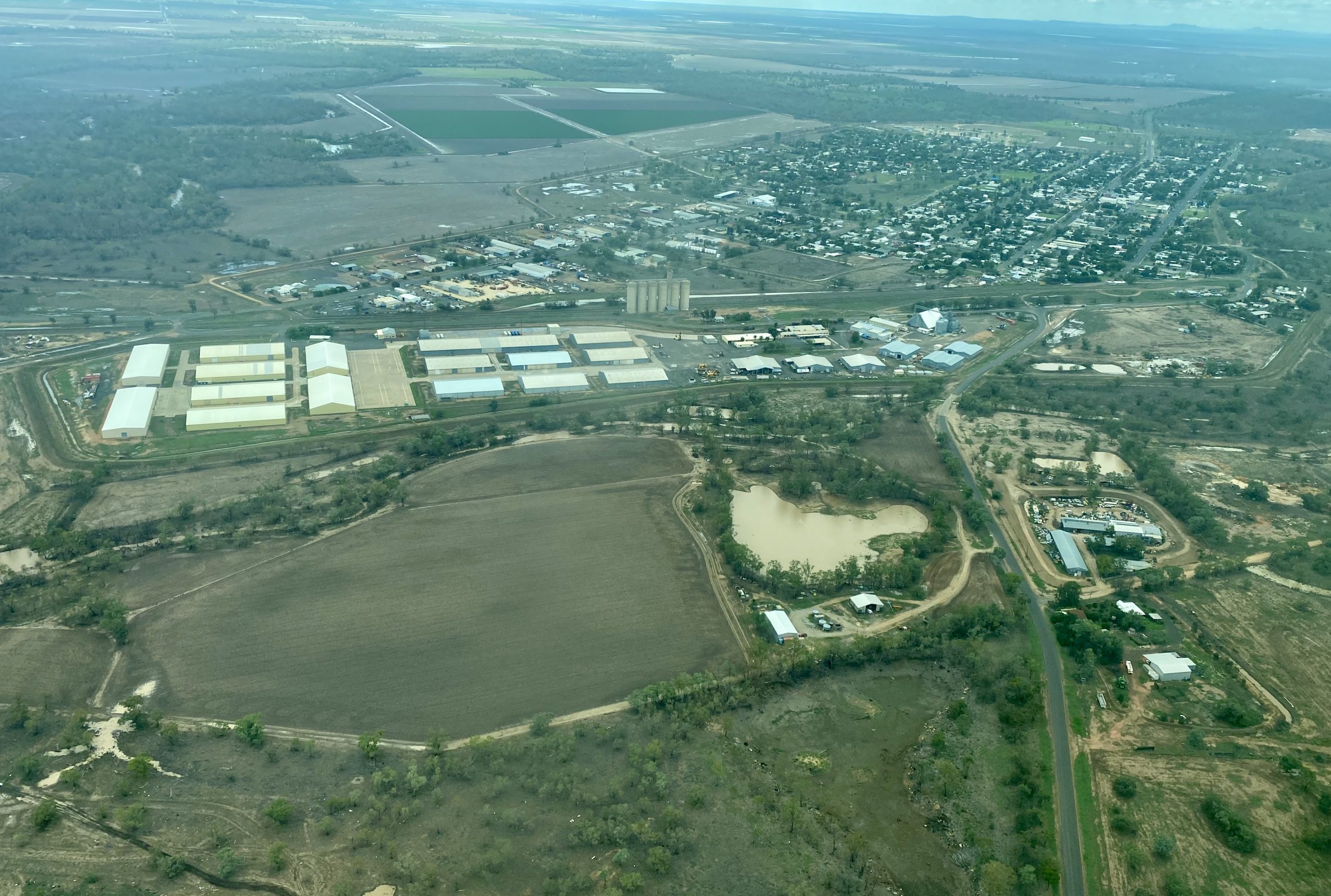
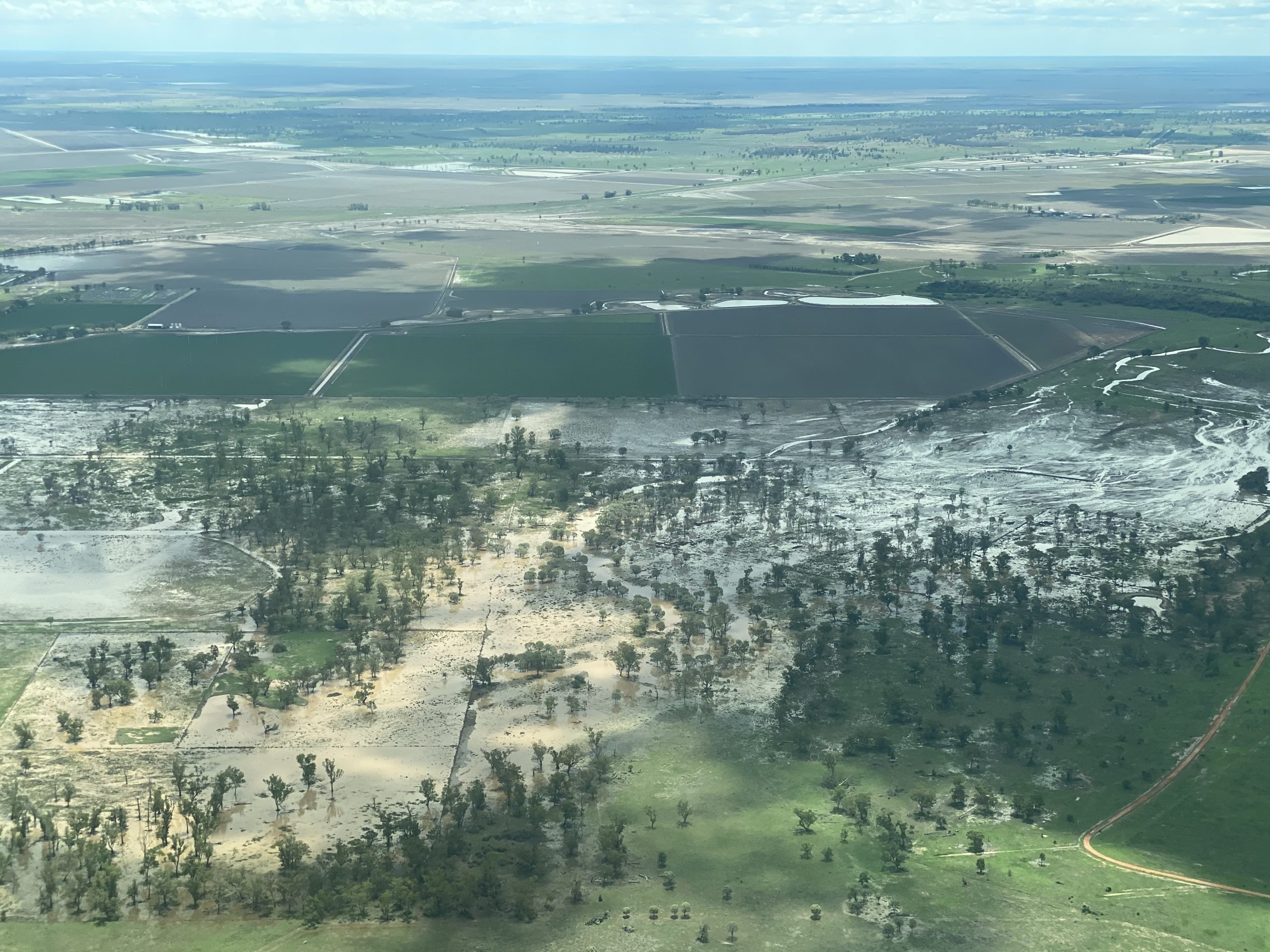
A bird’s eye view of the Namoi Valley after the recent rainfall shows how our region can flourish if you ‘just add water’.
It’s also clear that the weather event has delivered varying scenarios – some people are turning the corner after years of drought, some are waiting for more rain and others are dealing with too much, falling too quickly.
The Courier was fortunate enough to hitch a ride with Exact Aviation owner and pilot Angus Ashby on Tuesday to capture some aerial shots of wet paddocks, green pastures, flowing water and the glorious sight of Yarrie Lake starting to fill up.


“It goes to show that if you give the soil here a bit of water – then away it goes,” said Merah North farmer Jono Phelps who was also on board the flight that tracked the Namoi River and creeks between Narrabri and Walgett.
“It’s lifted everyone’s spirits,” added Mr Phelps.
“It was wonderful to see the river running towards Walgett to help the Walgett town and weir situation, and replenish the supply of water.”
Mr Phelps said he hadn’t seen a rain event like it since 2016 and while it’s not drought-breaking, it is very welcome.
In terms of the broader benefits to farmers and businesses in the district, Mr Phelps said “no money was flowing from the rain yet but it does give people confidence that it will flow at some stage”.
For agricultural businesses like Angus Ashby’s aerial spraying company the rain is no doubt a relief.
“It definitely improves security for our business,” said Exact Aviation owner and pilot Angus Ashby.
“Just the fact that there’s now an opportunity that there will be a winter crop and that it will generate work for (agricultural) businesses.
“In the short term, it will generate work in controlling weeds in fallows for people who can’t get on their paddocks due to the fact it’s too wet.”
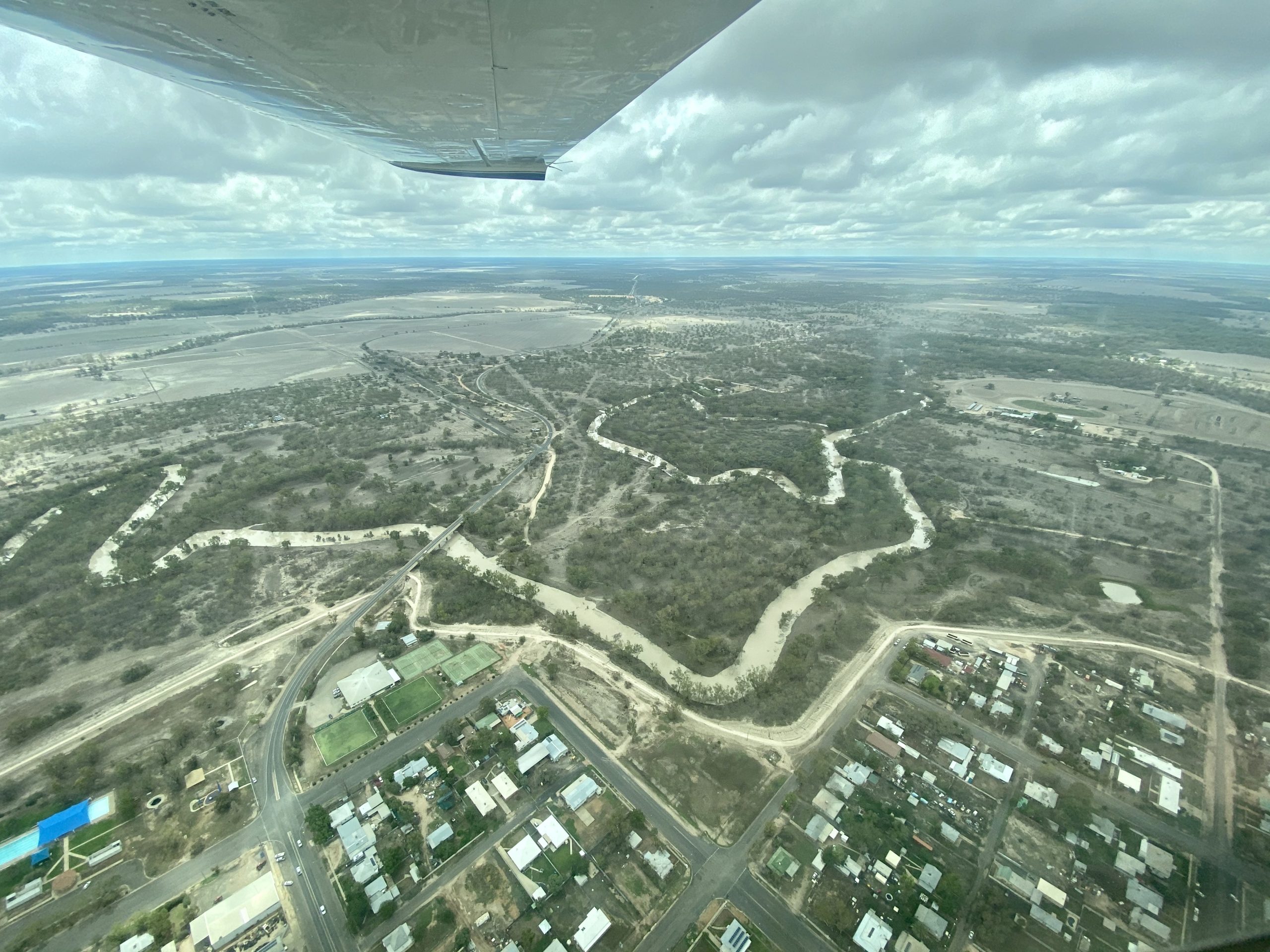
Of course as a pilot, Mr Ashby has had a clear and unique view from his cockpit of the widespread and devastating impact of the drought on our landscape.
“It’s amazing how quickly it can turnaround but also how patchy it can be,” said Mr Ashby.
“More so how you can go from a tough drought and then in two weeks see the country turnaround, and see running water in places.
“But I’ve also witnessed some of the destruction it has caused.”
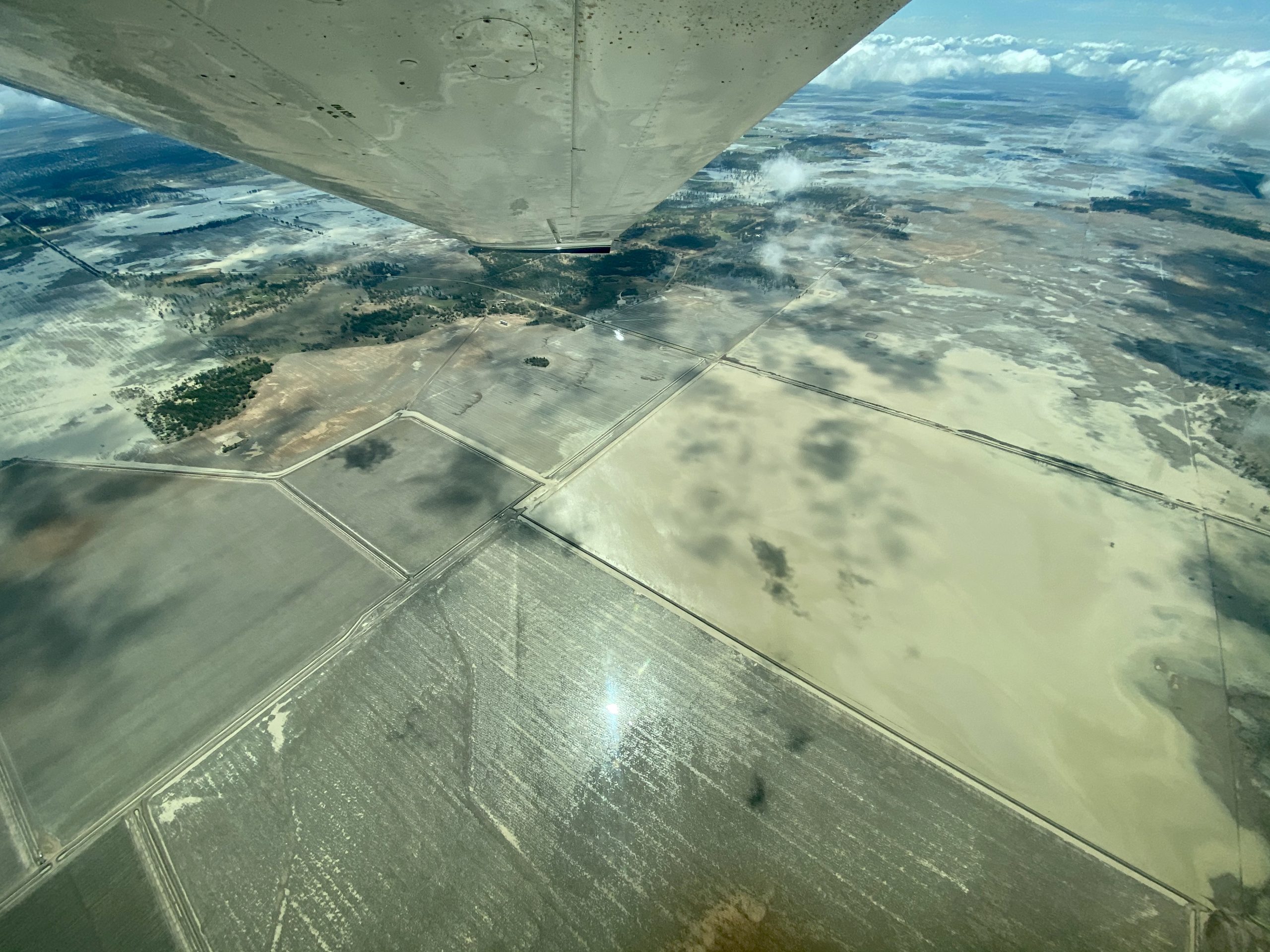
Mr Ashby said that because farm paddocks have been so bare, in some situations, rainfall is more likely to run off the ground rather than infiltrate. And therefore more extreme overland flows are the result.
“This weather is seeing well over 100 millimetre events in one go which has been over the course of two to three hours, it’s a lot of water to fall in one position and expect the country to soak it up.”
Farmer and Namoi Water executive officer Jon-Maree Baker was also onboard the flight and said that the sky-high view showed that the recent storm activity had been a “mixed bag”.
“For some it brought drought-breaking rain, for others including parts of Narrabri it was a flash flood, and for others not much rain at all.
“The Namoi River has a substantial flow as a result of the rain and flows from the Peel, this flow is going to connect the Namoi River and there will also be a flow through Pian Creek bringing long awaited stock and domestic flows to farmers at the end of the Pian,” said Ms Baker.


On Friday February 7, the Department of Industry – Water made an initial decision, very late in the afternoon at 4.38pm, to place an embargo on floodplain harvesting in the northern region.
Floodplain harvesting is the capture and use of water flowing across a floodplain during a flood event. It is an important source of water for the agricultural industry but can also prevent damage to infrastructure.
Ms Baker said that Namoi communities and irrigators have supported the protection of flows for critical human needs for decades and that securing water for downstream towns is the primary reason an embargo is applied by the Department, and it only happens when we are in the worst of droughts.
However, for many farmers in the Namoi Valley it was difficult to access information about exactly how the embargo applied to them.
“The key issue for most Namoi farmers has been getting clear information from the Department about what they could and couldn’t do so they could manage their farms within these rules,” said Ms Baker.
“This is the first time there has been an embargo on floodplain harvesting and given it was applied late on Friday afternoon, no one knew what was in and what was out.
“That’s why we have repeatedly asked for the public interest test to be more transparent, have a clear process and have an agreed system to manage a natural system that changes rapidly.”
Ms Baker said she understands that the “first flush” in the northern river system was always going to be difficult to manage in terms of expectation and the concern from downstream.
“The rainfall intensity and where and how it fell makes managing the risk to roads, towns, houses and farms important in terms of how the Department responds,” she said.
“An example of the need for a responsive approach, is the 145 mm that fell overnight and resulted in Mulgate and Doctors Creeks flooding the Namoi River causing it to flow backwards.
“Likewise the flows from Spring and Bobbiwa Creeks that put pressure on farms, roads and irrigation infrastructure that required flexibility in how farmers can manage this floodwater.”
On Tuesday, the Department of Water said that all interim flow targets had been met and responded to concerns about risks to farm infrastructure as well as the management of flood flows by allowing a three day window from February 10 to 13 for floodplain harvesting access in at-risk areas.
“Over the last three days there has been in excess of 250 mm of rain in some locations across the Namoi and lower Gwydir,” read a statement released by Vanessa O’Keefe, executive director of water planning policy for the Department of Planning Industry and Environment.
“This has resulted in large volumes of overland flow on the floodplains in these areas, as well as flash flooding.
“All interim flow targets have been met in the Namoi valley, and it is now forecast that interim targets will be met at Tilpa, and possibly Wilcannia, on the Barwon Darling system.
“The main intent of lifting this order is to minimise flood impacts, and allow farmers to move water around their property to avoid damage to on-farm infrastructure.
“The temporary lifting of this order will also allow some access to floodplain water.
“Due to these conditions, I am satisfied there is sufficient water available for higher priority needs to approve the take of floodplain water at the locations.”
Member for Barwon Roy Butler, who has the difficult task of representing the largest electorate in NSW – spanning from Broken Hill in the west to Boggabri in the north-east – has criticised the decision to lift the embargo despite the reasons outlined by the Department.
“All across my electorate are people who are struggling due to the protracted drought, this week some of them were lucky enough to receive more rain than we’ve had in years, others have received nothing,” said Mr Butler in a statement on Wednesday.
“For those who received nothing, and look out on a dry river bed they had hoped that water would make its way down from the north.
“Their optimism was bolstered when an embargo was placed on this water.
“Minister Pavey has just ripped that optimism from them and replaced it with anxiety and uncertainty.”
Mr Butler’s statement said that Water Minister Melinda Pavey’s decision “to backflip on an embargo and waive restrictions on take in several tributaries and parts of the Peel, Namoi and Gwydir Rivers doesn’t pass the pub test”.
He said that a “perfect storm of misinformation” had been created.
“What Minister Pavey has achieved here is the creation of conflict between communities. Who does that benefit?”.
Mr Butler said that he wrote to Minister Pavey in January asking for more transparency around section 324 embargoes.
“People are fed up with decisions about water being made under a shroud of secrecy.
“People’s livelihoods and the future of communities hang off these decisions – we’ve all had enough of the total disregard from the government.
“That’s why I have introduced legislation to bring water decision making back to the Parliament and back to the people of NSW. And it’s why I continue to push for a Federal Royal Commission.”
Minister Pavey released a statement on Wednesday and said embargoes were placed on farmers across the Barwon Darling over the weekend, to replenish the river systems as much as possible. And repeated the Department’s reasons and concerns.
“Over the past three days there has been more than 250mm of rain in some locations across the Namoi and Lower Gwydir, resulting in large volumes of overland flow on the floodplains in these areas, but also flash flooding and property damage.”
Minister Pavey said the Natural Resources Access Regulator and the Flood Plain Harvesting team took to the air on Tuesday to investigate the extent of flooding and check reports of infrastructure damage.
Minister Pavey said that while embargoes remain in place along the Northern Valley and Barwon Darling Rivers, a small number of temporary exemptions were given to properties affected by flooding.
She said the suspensions were only temporary and restrictions are expected to be put back in place on Wednesday.
“It is a relief to see naturally occurring flows running all the way down the Barwon River from Mungindi to Walgett, likely to replenish town supply weirs at Brewarrina and Bourke and we’re hopeful even down to Menindee Lakes,” Mrs Pavey said.
Ms Baker recognises that many communities downstream have not had any rain.
“Hence the confidence these flows are being protected is important,” she said.
Ms Baker urged people criticising floodplain harvesting to take the time to understand the facts.
“Embargoes are applied and lifted by the Department of Industry – Water, and access to flows will only be provided after the targets for critical human need requirements are met,” said Ms Baker.
“There has been a lot said about floodplain harvesting by those outside our community, the facts are that farm works like channels and irrigation areas are legal, they are licensed under a flood work approval and many have been in place since the early 1990s.
“This is not a new form of water access, it is legitimate and an important part of a system that has floods and floodplains.
“The Department following assessment of the river flows which demonstrated that flows will reach the key targets and considering the high intensity rainfall in some areas, lifted temporary restrictions to assist those individuals in managing on-farm water.
“Those who live on the floodplain know that managing a flood in real time is challenging.
“We know they can be both damaging and a life support.
“It’s important we recognise that flood works are designed across these floodplains to protect infrastructure like roads, towns as well as farms.
“What we really want is to know what we can and can’t do and a clear process for how this is assessed.
“This flow is important, it’s important here and downstream attacks on farmers that are managing within the rules given to them is not acceptable, this water will mean a winter crop and our region needs it.”
To order photos from this page click here