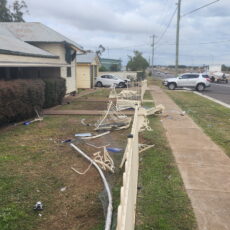
Major thoroughfares across the North West, in addition to many shire roads, have been impacted by recent wet weather and rising river levels.

NSW Roads advised that the Kamilaroi Highway, between Gunnedah and Boggabri, was expected to close to traffic on Tuesday afternoon.

Flooding has also impacted the Oxley Highway between Gunnedah and Carroll.

Narrabri Shire Council issued the following update late on Tuesday morning:
• SR61 Turrawan Road – Closed to all traffic.
• SR11 Harparary Road – Closed to all traffic
• SR59 Cains Crossing Road – Closed to all traffic.
• Violet street (Low level bridge) – Closed to all traffic.
• SR218 Prices Lane – Closed to all traffic.
• SR57 Mayfield Road – Closed to all traffic.
• SR227 Pine Creek Road – Closed to all traffic.
• SR17 Old Narrabri Road – Closed to all traffic.
• SR212 Sandy Hook Lane – Closed to all traffic.
• SR82 Womera Creek Road – Closed to all traffic.
• SR111 Appletrees Lane – Closed to all traffic.
• SR30 Culgoora Road – Closed to all traffic.
• SR3 Mellburra Road – Closed to all traffic.
• SR11 Harparary Road – Closed to all traffic.
• SR15 Therribri Road – Closed to all traffic.
• SR16 Browns Lane – Closed to all traffic.
• SR56 The Clump Road – Closed to all traffic.
• SR126 Valorban Lane – Closed to all traffic.
• SR9 Bald Hill Road – Closed to all traffic.
• SR105 Tarlee Road – Closed to all traffic.
• SR102 Boggy Creek – Closed to all traffic.
• SR107 Waiwera Lane – Closed to all traffic.
• SR112 Ten Mile Lane – Closed to all traffic.
• SR116 Galathera Lane – Closed to all traffic.
• SR55 Homestead Road – Closed to all traffic.
• SR39 Gwabegar Road – Closed to all traffic.
• SR7 Couradda Road – Closed to all traffic.
• SR1 Millie Road – Open with caution.
• SR22 Braymont Road – Closed to all traffic.
• SR27 Dripping Rock Road – Closed to all traffic.
• SR25 Curracabah Road – Closed to all traffic.
• SR101 Deni Lane – Closed to all traffic.
• SR144 Tea Tree Gully – Closed to all traffic.
• SR162 Yarranabee Road – Closed to all traffic.
• SR173 Pikes Lane – Closed to all traffic.
• SR123 Trevena Lane – Closed to all traffic.
• MR133 Killarney Gap Road – Closed to all traffic.
• MR329 Cypress Way – Closed to all traffic.
• MR357 Rangari Road – Closed to all traffic.
Gunnedah Shire Council issued the following update on Tuesday morning:
• Oxley Highway Gunnedah ROAD CLOSED – between Gunnedah and Carroll due to water over the road.
Kamilaroi Highway Curlewis to Breeza Boundary OPEN WITH CAUTION – from Curlewis to Breeza Boundary due to water over road in flood ways.
Kamilaroi Highway Gunnedah to Boggabri OPEN WITH CAUTION – between Gunnedah and the Boggabri boundary due to water over the road. (Note: NSW Roads later issued an alert that the highway was expected to close on Tuesday afternoon).
Bloomfield Street/Warranbungle Street Heavy Vehicle Bypass ROAD CLOSED – between Tempest Street and Conadilly Street.
Cohens Bridge O’Keefe Avenue ROAD CLOSED between Chandos Street and Old Blue Vale Road.
Maitland Street Gunnedah ROAD CLOSED – between Chandos Street and Rosemary Street.
Grain Valley Road Mullaley to Boggabri ROAD CLOSED – from Mullaley to Boggabri.
Rangari Road Rangari ROAD CLOSED – between Kamilaroi Highway and Kelvin Road.
Black Stump Way Mullalay to Tambar Springs ROAD CLOSED – at McBurnies Crossing.
Rushes Creek Road Carroll ROAD CLOSED – between the Keepit Dam Road intersection and Manilla.
Orange Grove Road Gunnedah ROAD CLOSED – between Kelvin Road and Keepit Dam Road.
Blue Vale Road Gunnedah ROAD CLOSED – between Old Blue Vale Road and Braymont Road.
Quia Road Gunnedah OPEN WITH CAUTION – between Black Jack Road and Goolhi Road.
Goolhi Road Emerald Hill OPEN WITH CAUTION – between Quia Station Road and Edmonds Road.
Goolhi Road Marys Mount ROAD CLOSED – between Marys Mount Road and Grain Valley Road.
Kelvin Road Gunnedah OPEN WITH CAUTION – between Old Blue Vale Road and Rangari due to water over the road in causeways.
Wean Road Wean OPEN WITH CAUTION – between Kelvin Road and O’Brien Road due to water over the road in causeways.
Preston Road Gunnedah OPEN WITH CAUTION – between Wandobah Road and Thompson Road due to road surface damage.
Wandobah Road Gunnedah ROAD CLOSED – between Preston Road and Trinkey Forest Road due to water over the road.
Clifton Road Breeza ROAD CLOSED – from Carroll to Breeza.
Bulunbulun Road Breeza ROAD CLOSED – between Kamilaroi Highway and the boundary with Liverpool Plains Shire Council.
Long Point Road Breeza ROAD CLOSED – between Pullaming Road and Norman Road at the low level crossing.
Mooki River Road Breeza ROAD CLOSED – at the Mooki River crossing between Maitland Street and Bulubulun Road.
Round Hill Road Breeza ROAD CLOSED – between Perfrement Road and Clifton Road.
 Kilphysic Road Carroll OPEN WITH CAUTION – from Clifton Road to end due to road surface damage.
Kamilaroi Road Gunnedah OPEN WITH CAUTION – from Eveleigh Road to the end due to road surface damage.
Trinkey Forest Road Tambar Springs ROAD CLOSED – between Black Stump Way and Wandobah Road.
Pullaming Road Piallaway ROAD CLOSED – between Kamilaroi Highway and Clifton Road.
Oakey Creek Road Piallaway ROAD CLOSED – between Clifton Road and Piallaway Road.
Curlewis Common Road Curlewis ROAD CLOSED – between Kamilaroi Highway and Pullaming Road.
Normans Road Piallaway ROAD CLOSED – between Clifton Road and Long Point Road.
Goran Lake Road Curlewis ROAD CLOSED – between Nea Siding Road and South Wandobah Road.

To order photos from this page click here